
As usual, I was on Google Maps.
I was actually doing research, rather than doing my regular antic of perusing a country I’ve never heard of hours after starting off on a restaurant a mile away from my house. You know when people fall down the YouTube rabbit hole? Me, I fall down the Google Maps rabbit hole. It’s a problem.
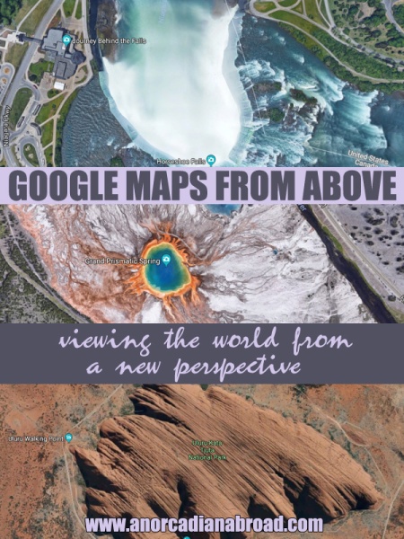
But this time, I was actually on track. I was looking up Yellowstone National Park, to try to plan routes, stops, camping… and then I turned on the satellite image over Grand Prismatic Spring.
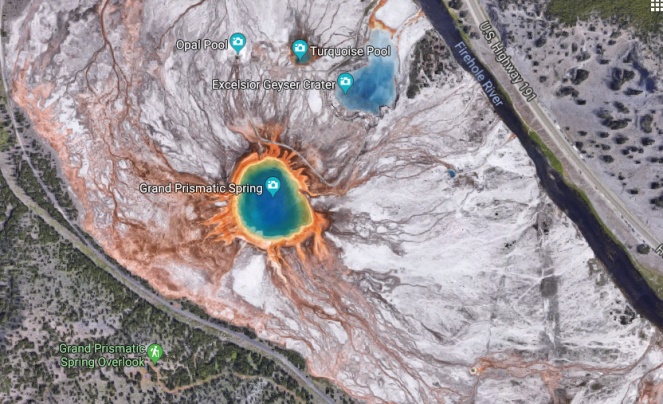
Whoa.
So that got me thinking – what do other places around the world look like on Google Maps? In a world of drones and suddenly seeing everything from above, seeing the world from a birds eye view is the new in thing – but you don’t need to worry about exclusion zones on Google Maps.
Well, I decided to have a little explore. (Which, yes, led me down a very large rabbit hole that I was finding quite comfortable to be in)
So here’s a bit of a different post today. Here are some of my favourite discoveries!
Niagara Falls, Canada/US

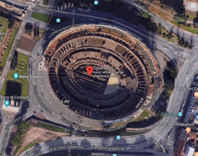
The Colosseum, Rome, Italy
Uluru, Australia

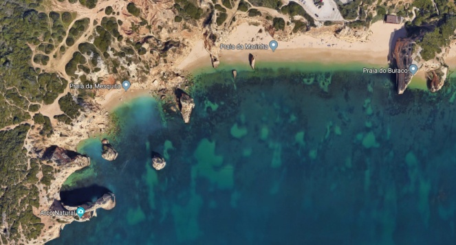
Praia da Marinha beach, Portugal
Whitsundays, Australia

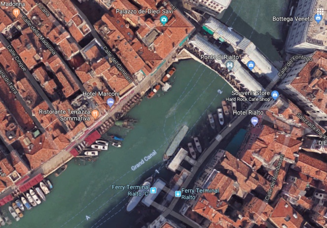
Rialto Bridge, Venice, Italy
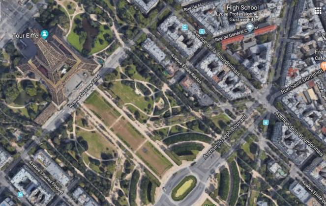
Eiffel Tower, Paris, France
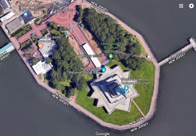
Statue Of Liberty, New York City, USA
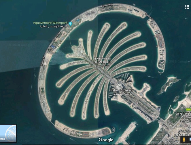
Palm Island, Dubai
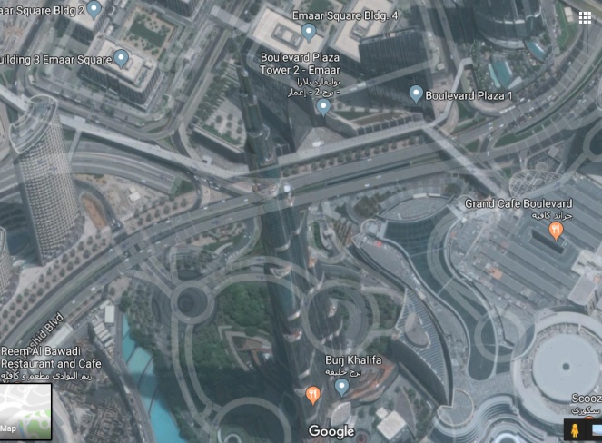
I also had a look at the Burj Khalifa from above, but it looks really strange on Google satellite, and actually kinda looks futuristic!
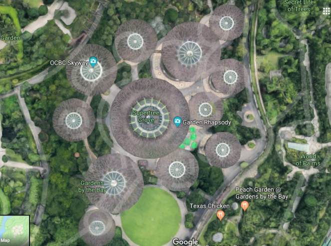
Gardens By The Bay, Singapore
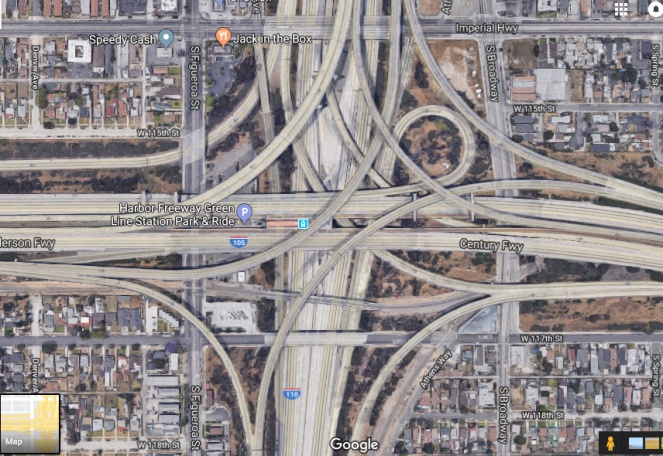
Judge Harry Pregerson Interchange, LA, USA
(A road I will be trying to avoid on our road trip!!!!)
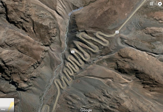
Los Caracoles Pass, Chile
Christ The Redeemer, Rio de Janeiro, Brazil
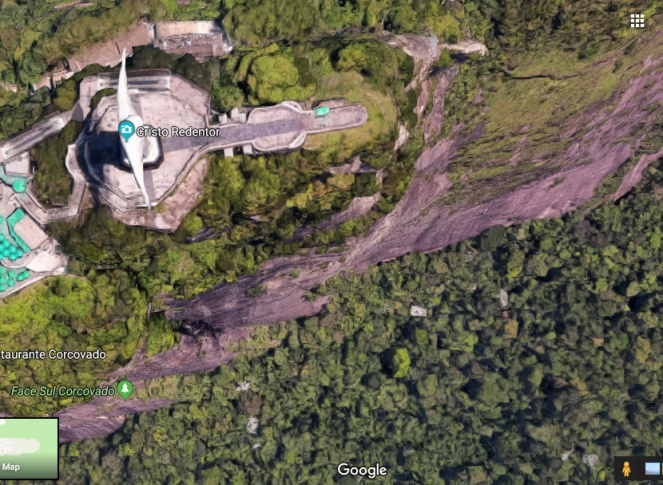
My favourite part of this one wasn’t the view of the statue, but when you move over it, the depth perception is insane! I actually felt it. Take a look for yourself!!
There are tons of places that I looked up that just don’t look that great from above (like Sydney Opera House) or places that don’t show up well on Google Maps, like the Egyptian pyramids, Mount Everest and Milford Sound! But I had a lot of fun exploring the world from above – I’m not sure what that says about me and my life, to be honest!! #GoogleMapAddict
Have you found any really cool gems on Google Maps?
Like this post? Pin it to read later!

Haha I love this! My first app ever on my iPhone was Google Earth – it is definitely easy to get lost exploring our gigantic world!
LikeLike
Google Earth is amaaaazing, and street view too!
LikeLike
I love this! I always look at Google Earth when planning new places to visit. It gives you a good idea of what to expect when you get there too.
LikeLike
Yeah I like to have a nosey on street view when I’m visiting somewhere, although I try not to look at too much because half the fun is exploring when you actually get there! 🙂
LikeLike
What a great thing to accidentally discover! I’ve never done this either, but will definitely try it now. I think my favorite view you discovered was the Whitsundays. I love the way their famous white sand is wisping out into the sea!
LikeLike
Thanks!! I know, it looks unreal haha. It gives everything a whole new perspective. 🙂
LikeLike